UNESCO World Heritage Sites
Sometimes it is not only the kilometers that we do but all has to do with the experience, the interaction with the people and their local heritage. It is important to know the cultural events, the history and the archeology which makes the legacy of a site. Here are some of the places that makes this adventure much richer in culture and the heritage.
Heart of Neolithic – Standing Stones – Orkney, Scotland | Edinburgh Old and New Towns – Edinburgh, Scotland | Island of Mozambique – Mozambique | Elvas Aqueduct – Portugal | Stonehenge, Avebury and Associated Sites – England | Tower of Hercules – Coruna, Spain | Mosi-oa-Tunya / Victoria Falls Zambia/ Zimbabwe | Namib Sand Sea – Namibia | Works of Antoni Gaudí – Spain | Historic Centre of Oporto, Luiz I Bridge and Monastery of Serra do Pilar | Okavango Delta – Botswana | Island of Saint-Louis – Senegal | Moussem of Tan Tan – Morocco | Medina of Essaouira (formerly Mogador) – Morocco | Medina of Fez – Morocco | Medina of Marrakesh – Morocco | Medina of Tétouan (formerly known as Titawin) – Morocco | Bwindi Impenetrable National Park – Uganda | Rwenzori Mountains National Park – Uganda | Tombs of Buganda Kings at Kasubi – Uganda | Maloti-Drakensberg Park – Lesotho | Old City of Salamanca – Spain | Alto Douro Wine Region – Portugal | Nice, Winter Resort Town of the Riviera – France | Pyrénées – Mont Perdu – Spain/ France | Historical Complex of Split with the Palace of Diocletian – Croatia | Su Nuraxi di Barumini – Sardinia, Italy | Gulf of Porto: Calanche of Piana, Gulf of Girolata, Scandola Reserve, Corsica France | Old City of Dubrovnik – Croatia | The Hormuzi – Portuguese Fortress – Qal’ at al-Bahrain – Kingdom of Bahrain | Bujairi Diriyah “The city of Hearth and the Jewel of the Saudi Arabia Kingdom.

Heart of Neolithic – Standing Stones – Orkney, Scotland
Heart of Neolithic Orkney refers to a group of Neolithic monuments found on the Mainland of the Orkney Islands, Scotland. The name was adopted by UNESCO when it proclaimed these sites as a World Heritage Site in 1999.
Edinburgh Old and New Towns – Edinburgh, Scotland
“Edinburgh Old and New Towns” were together inscribed as a World Heritage Site in 1996. The former includes the medieval Royal Mile which runs from Edinburgh Castle to the Palace of Holyroodhouse, and is bordered to the north by the neo-classical 18th century “New Town” which includes Princes Street. It is managed by the Edinburgh World Heritage Trust.
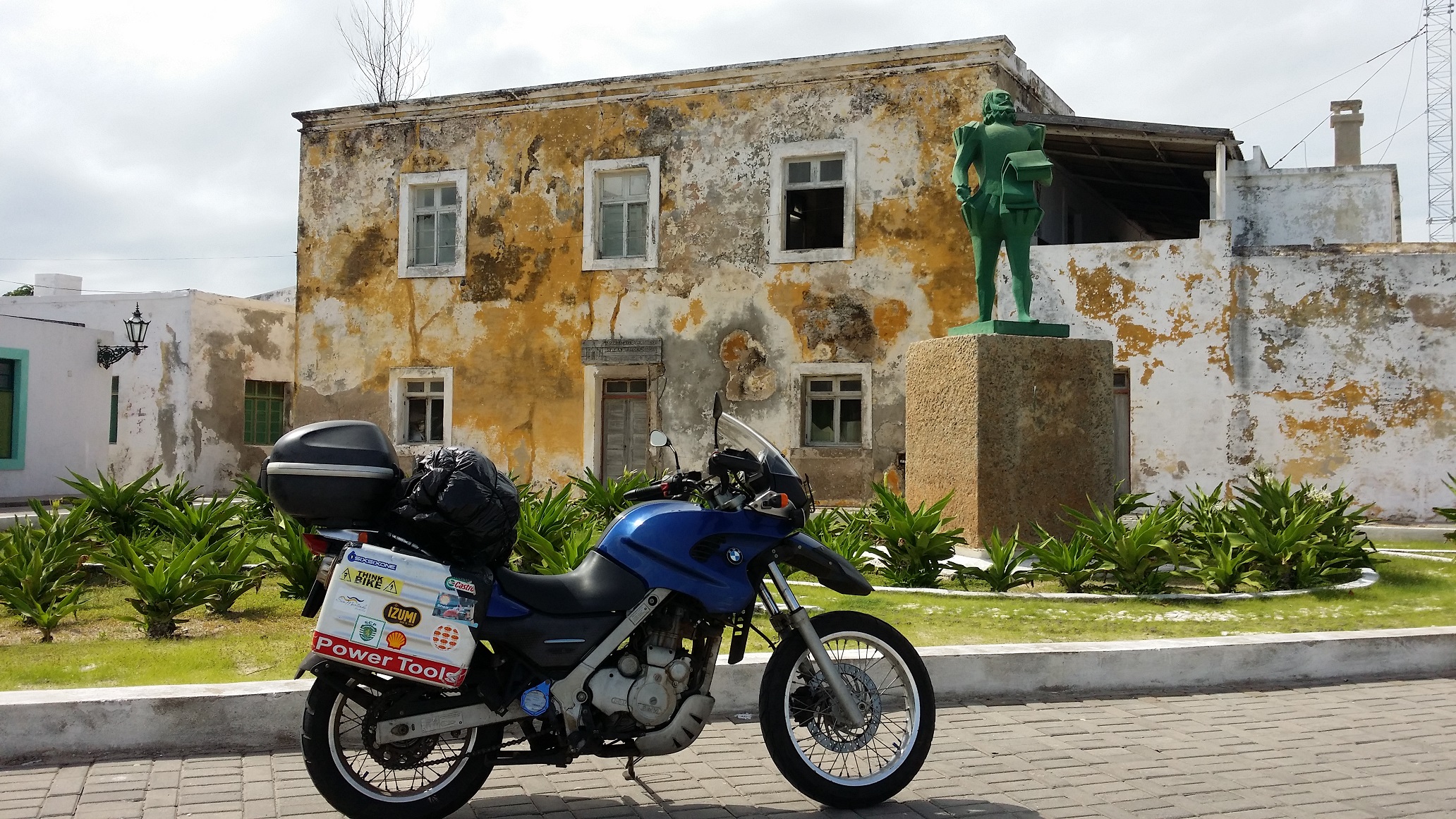
Island of Mozambique – Mozambique
The fortified city of Mozambique is located on this island, a former Portuguese trading-post on the route to India. Its remarkable architectural unity is due to the consistent use, since the 16th century, of the same building techniques, building materials (stone or macuti) and decorative principles.
Elvas Aqueduct – Portugal
The Amoreira Aqueduct, in Alentejo, is located in the parishes of Caia, São Pedro and Alcáçova, in the municipality of Elvas, in the district of Portalegre, in Portugal. Connects the place of Amoreira to the city of Elvas. With 8.5 kilometers in length, 843 arches with more than five arches and towers that rise to 31 meters in height, it is considered the largest aqueduct in the Iberian Peninsula.
Stonehenge, Avebury and Associated Sites – England
Stonehenge and Avebury, in Wiltshire, are among the most famous groups of megaliths in the world. The two sanctuaries consist of circles of menhirs arranged in a pattern whose astronomical significance is still being explored. These holy places and the nearby Neolithic sites are an incomparable testimony to prehistoric times.
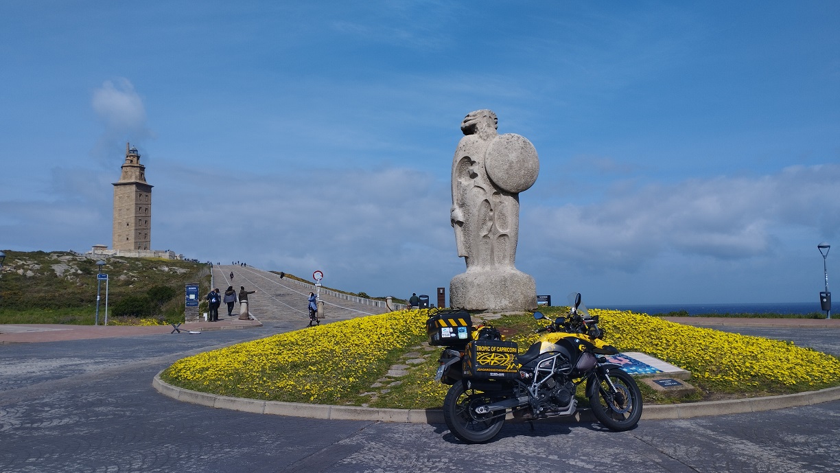
Tower of Hercules – Coruna, Spain
The Tower of Hercules has served as a lighthouse and landmark at the entrance of La Coruña harbour in north-western Spain since the late 1st century A.D. when the Romans built the Farum Brigantium. The Tower, built on a 57 metre high rock, rises a further 55 metres, of which 34 metres correspond to the Roman masonry and 21 meters to the restoration directed by architect Eustaquio Giannini in the 18th century, who augmented the Roman core with two octagonal forms. Immediately adjacent to the base of the Tower, is a small rectangular Roman building. The site also features a sculpture park, the Monte dos Bicos rock carvings from the Iron Age and a Muslim cemetery. The Roman foundations of the building were revealed in excavations conducted in the 1990s. Many legends from the Middle Ages to the 19th century surround the Tower of Hercules, which is unique as it is the only lighthouse of Greco-Roman antiquity to have retained a measure of structural integrity and functional continuity.
Mosi-oa-Tunya / Victoria Falls (Zambia/ Zimbabwe)
These are among the most spectacular waterfalls in the world. The Zambezi River, which is more than 2 km wide at this point, plunges noisily down a series of basalt gorges and raises an iridescent mist that can be seen more than 20 km away. The Mosi-oa-Tunya/Victoria Falls is the world’s greatest sheet of falling water and significant worldwide for its exceptional geological and geomorphological features and active land formation processes with outstanding beauty attributed to the falls i.e. the spray, mist and rainbows. This transboundary property extends over 6860 ha and comprises 3779 ha of the Mosi-oa-Tunya National Park (Zambia), 2340 ha of Victoria Falls National Park (Zimbabwe), 741 ha of the riverine strip of Zambezi National Park (Zimbabwe). A riverine strip of the Zambezi National Park extending 9 km west along the right bank of the Zambezi and islands in the river are all within the Park as far as Palm and Kandahar Islands, with the Victoria Falls being one of the major attractions. The waterfall stands at an altitude of about 915 m above mean sea level (a.m.s.l.) and spans to about 1708 m wide with an average depth of 100 m and the deepest point being 108 m. Sprays from this giant waterfall can be seen from a distance of 30 km from the Lusaka road, Zambia and 50 km from Bulawayo road, Zimbabwe. Basalts have been cut by a river system producing a series of eight spectacular gorges that serve as breeding sites for four species of endangered birds. The basalts of the Victoria Falls World Heritage property are layered unlike those of the Giants Causeway World Heritage site which are vertical and columnar.
Namib Sand Sea – Namibia
Namib Sand Sea is the only coastal desert in the world that includes extensive dune fields influenced by fog. Covering an area of over three million hectares and a buffer zone of 899,500 hectares, the site is composed of two dune systems, an ancient semi-consolidated one overlain by a younger active one. The desert dunes are formed by the transportation of materials thousands of kilometers from the hinterland, that are carried by river, ocean current and wind. It features gravel plains, coastal flats, rocky hills, inselbergs within the sand sea, a coastal lagoon and ephemeral rivers, resulting in a landscape of exceptional beauty. Fog is the primary source of water in the site, accounting for a unique environment in which endemic invertebrates, reptiles and mammals adapt to an ever-changing variety of microhabitats and ecological niches.
Works of Antoni Gaudí – Spain
Seven properties built by the architect Antoni Gaudí (1852–1926) in or near Barcelona testify to Gaudí’s exceptional creative contribution to the development of architecture and building technology in the late 19th and early 20th centuries. These monuments represent an eclectic, as well as a very personal, style which was given free reign in the design of gardens, sculpture and all decorative arts, as well as architecture. The seven buildings are: Parque Güell; Palacio Güell; Casa Mila; Casa Vicens; Gaudí’s work on the Nativity façade and Crypt of La Sagrada Familia; Casa Batlló; Crypt in Colonia Güell.
Historic Centre of Oporto, Luiz I Bridge and Monastery of Serra do Pilar
The Historic Centre of Oporto, Luiz I Bridge and Monastery of Serra do Pilar, built along the hills overlooking the mouth of the Douro River in northern Portugal, is an outstanding urban landscape with a 2,000-year history. The Romans gave it the name Portus, or port, in the 1st century BC. Military, commercial, agricultural, and demographic interests came together in this place. Its continuous growth linked to the sea can be seen in its many and varied monuments, from the cathedral with its Romanesque choir to the neoclassical Stock Exchange and the typically Portuguese Manueline-style Church of Santa Clara. The urban fabric of the Historic Centre of Oporto and its many historic buildings bear remarkable testimony to the development over the past thousand years of a European city that looks outward to the sea for its cultural and commercial links.
Okavango Delta – Botswana
This delta in north-west Botswana comprises permanent marshlands and seasonally flooded plains. It is one of the very few major interior delta systems that do not flow into a sea or ocean, with a wetland system that is almost intact. One of the unique characteristics of the site is that the annual flooding from the River Okavango occurs during the dry season, with the result that the native plants and animals have synchronized their biological cycles with these seasonal rains and floods. It is an exceptional example of the interaction between climatic, hydrological and biological processes. The Okavango Delta is home to some of the world’s most endangered species of large mammal, such as the cheetah, white rhinoceros, black rhinoceros, African wild dog and lion.
Island of Saint-Louis – Senegal
Founded as a French colonial settlement in the 17th century, Saint-Louis was urbanized in the mid-19th century. It was the capital of Senegal from 1872 to 1957 and played an important cultural and economic role in the whole of West Africa. The location of the town on an island at the mouth of the Senegal River, its regular town plan, the system of quays, and the characteristic colonial architecture give Saint-Louis its distinctive appearance and identity. The Island of Saint-Louis, oceanic port of West Africa, constitutes a unique landscape. Indeed, this miniscule strip of land, today wedged between two arms of the mouth of the Senegal River, enjoys an exceptional environment – a subtle marriage between land and water. As the first French chartered company on the Atlantic coast of African in 1659, the Island of Saint-Louis became the hub for European traders travelling up the river year round in search of slaves but also gum Arabic, gold, leather and other products. The little oceanic city was the political capital of the colony and French West Africa (FWA) up until 1902, and capital of Senegal and Mauritania up until 1957, before falling into decline due to the transfer of the capital to Dakar.
Moussem of Tan Tan – Morocco
The Moussem (fair) of Tan-Tan, held in September, annually brings together more than 30 nomadic tribes of the Sahara, is a living witness of oral cultures and the Saharawi arts and in 2008 was classified by UNESCO as an Oral and Intangible Heritage of Humanity.
Medina of Essaouira (formerly Mogador) – Morocco
Essaouira is an exceptional example of a late-18th-century fortified town, built according to the principles of contemporary European military architecture in a North African context. Since its foundation, it has been a major international trading seaport, linking Morocco and its Saharan hinterland with Europe and the rest of the world.
Medina of Fez – Morocco
Founded in the 9th century and home to the oldest university in the world, Fez reached its height in the 13th–14th centuries under the Marinids, when it replaced Marrakesh as the capital of the kingdom. The urban fabric and the principal monuments in the medina – madrasas, fondouks, palaces, residences, mosques and fountains – date from this period. Although the political capital of Morocco was transferred to Rabat in 1912, Fez has retained its status as the country’s cultural and spiritual centre.
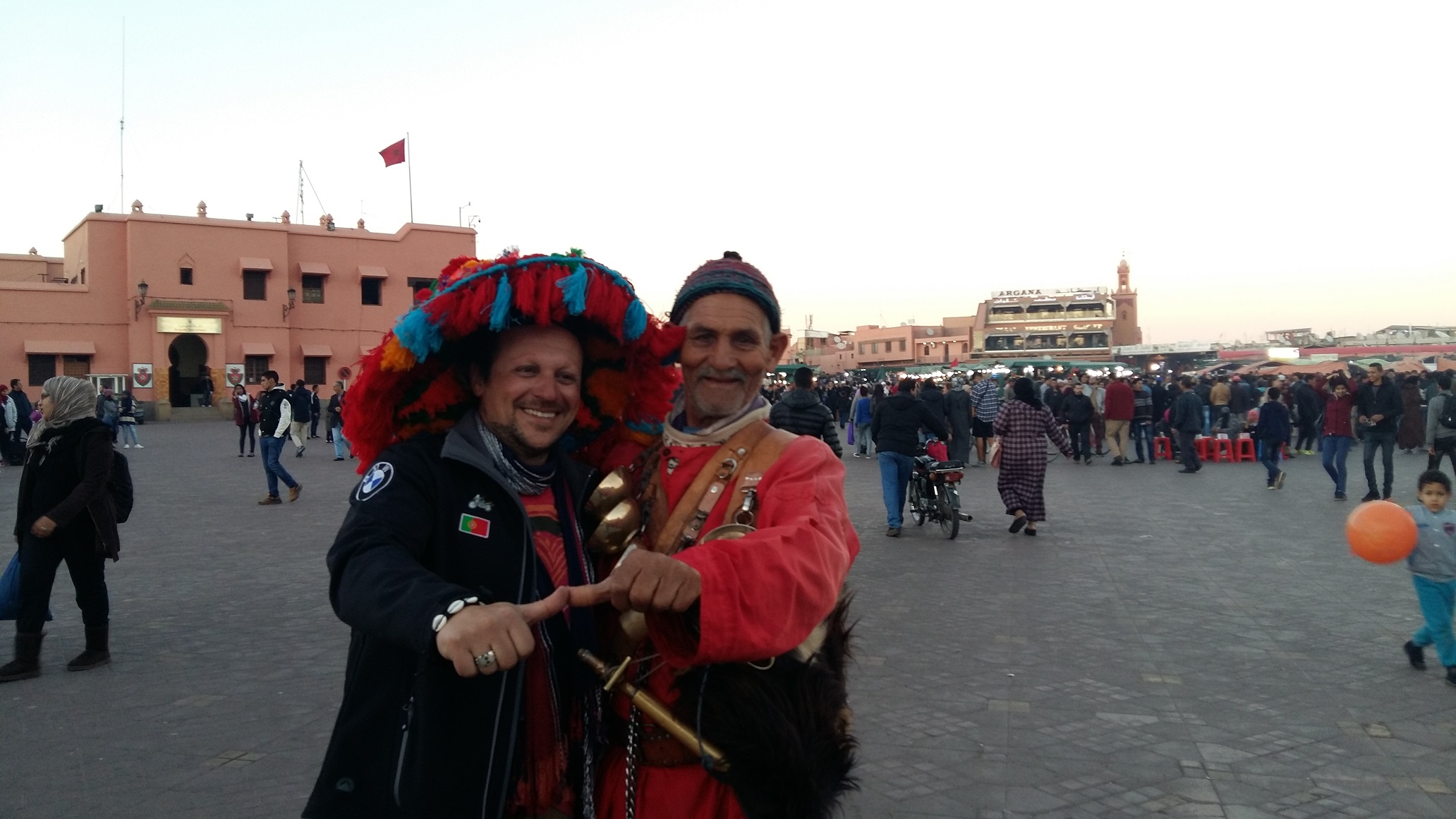
Medina of Marrakesh – Morocco
Founded in 1070–72 by the Almoravids, Marrakesh remained a political, economic and cultural Centre for a long period. Its influence was felt throughout the western Muslim world, from North Africa to Andalusia. It has several impressive monuments dating from that period: the Koutoubiya Mosque, the Kasbah, the battlements, monumental doors, gardens, etc. Later architectural jewels include the Bandiâ Palace, the Ben Youssef Madrasa, the Saadian Tombs, several great residences and Place Jamaâ El Fna, a veritable open-air theatre.
Medina of Tétouan (formerly known as Titawin) – Morocco
Tétouan was of particular importance in the Islamic period, from the 8th century onwards, since it served as the main point of contact between Morocco and Andalusia. After the Reconquest, the town was rebuilt by Andalusian refugees who had been expelled by the Spanish. This is well illustrated by its art and architecture, which reveal clear Andalusian influence. Although one of the smallest of the Moroccan medinas, Tétouan is unquestionably the most complete and it has been largely untouched by subsequent outside influences.
Bwindi Impenetrable National Park – Uganda
Located in south-western Uganda, at the junction of the plain and mountain forests, Bwindi Park covers 32,000 ha and is known for its exceptional biodiversity, with more than 160 species of trees and over 100 species of ferns. Many types of birds and butterflies can also be found there, as well as many endangered species, including the mountain gorilla.
Bwindi Impenetrable National Park, covering 32,092 ha, is one of the largest areas in East Africa which still has Afromontane lowland forest extending to well within the montane forest belt. Located on the eastern edge of the Albertine Rift Valley and believed to be a Pleistocene refugium, the property is a biodiversity hotspot with possibly the greatest number of tree species for its altitude in East Africa. It is also host to a rich fauna including a number of endemic butterflies and one of the richest mammalian assemblages in Africa. Home to almost half of the world’s mountain gorilla population, the property represents a conservation frontline as an isolated forest of outstanding biological richness surrounded by an agricultural landscape supporting one of the highest rural population densities in tropical Africa. Community benefits arising from the mountain gorilla and other ecotourism may be the only hope for the future conservation of this unique site.
Rwenzori Mountains National Park – Uganda
The Rwenzori Mountains National Park covers nearly 100,000 ha in western Uganda and comprises the main part of the Rwenzori mountain chain, which includes Africa’s third highest peak (Mount Margherita: 5,109 m). The region’s glaciers, waterfalls and lakes make it one of Africa’s most beautiful alpine areas. The park has many natural habitats of endangered species and a rich and unusual flora comprising, among other species, the giant heather.
The Rwenzori Mountains National Park provides stunning views of glacier and snow-capped mountains just kilometers from the equator, where it is contiguous with the Virunga National Park in the Democratic Republic of Congo (DRC). Having the third highest mountain in Africa at 5,109 m (after Kilimanjaro and Mount Kenya), the Park includes a much larger alpine area than either, covering an area of 99,600 ha of which 70% lies at over 2,500 m in height. The Rwenzori Mountains are the highest and most permanent sources of the River Nile, and constitute a vital water catchment. Their multitude of fast flowing rivers, magnificent waterfalls and stratified vegetation make the property exceptionally scenic and beautiful. The mountains are well-known for their unique alpine flora which includes many species endemic to the Albertine Rift in the higher altitude zones including giant heathers, groundsels and lobelias. The Park also supplies local communities with various wild resources and is an important cultural heritage.
Tombs of Buganda Kings at Kasubi – Uganda
The Tombs of Buganda Kings at Kasubi constitute a site embracing almost 30 ha of hillside within Kampala district. Most of the site is agricultural, farmed by traditional methods. At its core on the hilltop is the former palace of the Kabakas of Buganda, built in 1882 and converted into the royal burial ground in 1884. Four royal tombs now lie within the Muzibu Azaala Mpanga, the main building, which is circular and surmounted by a dome. It is a major example of an architectural achievement in organic materials, principally wood, thatch, reed, wattle and daub. The site’s main significance lies, however, in its intangible values of belief, spirituality, continuity and identity.
The site is the major spiritual Centre for the Baganda where traditional and cultural practices have been preserved. The Kasubi Tombs are the most active religious place in the kingdom, where rituals are frequently performed. Its place as the burial ground for the previous four kings (Kabakas) qualifies it as a religious Centre for the royal family, a place where the Kabaka and his representatives carry out important rituals related to Buganda culture. The site represents a place where communication links with the spiritual world are maintained.
Maloti-Drakensberg Park – Lesotho
The Maloti-Drakensberg Park is a transnational property composed of the uKhahlamba Drakensberg National Park in South Africa and the Sehlathebe National Park in Lesotho. The site has exceptional natural beauty in its soaring basaltic buttresses, incisive dramatic cutbacks, and golden sandstone ramparts as well as visually spectacular sculptured arches, caves, cliffs, pillars and rock pools. The site’s diversity of habitats protects a high level of endemic and globally important plants. The site harbors endangered species such as the Cape vulture (Gyps coprotheres) and the bearded vulture (Gypaetus barbatus). Lesotho’s Sehlabathebe National Park also harbors the Maloti minnow (Pseudobarbus quathlambae), a critically endangered fish species only found in this park. This spectacular natural site contains many caves and rock-shelters with the largest and most concentrated group of paintings in Africa south of the Sahara. They represent the spiritual life of the San people, who lived in this area over a period of 4,000 years.
Old City of Salamanca – Spain
This ancient university town north-west of Madrid was first conquered by the Carthaginians in the 3rd century B.C. It then became a Roman settlement before being ruled by the Moors until the 11th century. The university, one of the oldest in Europe, reached its high point during Salamanca’s golden age. The city’s historic centre has important Romanesque, Gothic, Moorish, Renaissance and Baroque monuments. The Plaza Mayor, with its galleries and arcades, is particularly impressive. Salamanca is an ancient university town situated in the west of Spain in the Autonomous Community of Castilla and León. The Carthaginians first conquered the city in the 3rd century B.C. It then became a Roman settlement before being ruled by the Moors until the 11th century. The university, one of the oldest in Europe, reached its high point during Salamanca’s Golden Age. The city’s historic Centre has important Romanesque, Gothic, Moorish, Renaissance, and Baroque monuments. The Plaza Mayor, with its galleries and arcades, is particularly impressive.
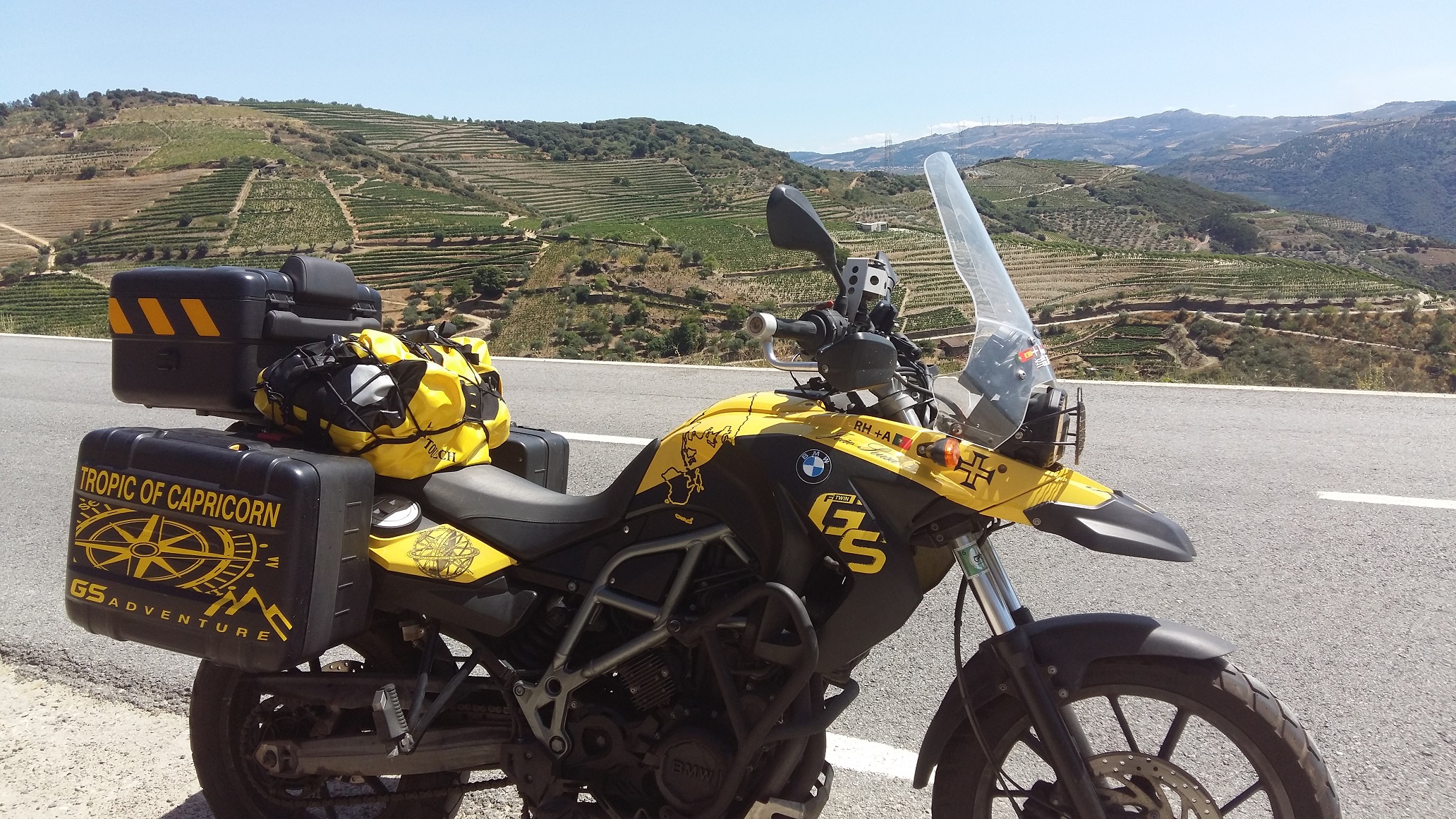
Alto Douro Wine Region – Portugal
Wine has been produced by traditional landholders in the Alto Douro region for some 2,000 years. Since the 18th century, its main product, port wine, has been world famous for its quality. This long tradition of viticulture has produced a cultural landscape of outstanding beauty that reflects its technological, social and economic evolution. The river Douro and its principal tributaries, the Varosa, Corgo, Távora, Torto, and Pinhão, form the backbone of the mountain landscape, which is protected from the harsh Atlantic winds by the Marão and Montemuro mountains, has been transformed by steeply sloping terraced vineyards that cover some 24,600 ha.
Nice, Winter Resort Town of the Riviera – France
The Mediterranean city Nice, near the Italian border, bears witness to the evolution of the winter climatic resort due to the city’s mild climate and seaside location at the foot of the Alps. From the middle of the 18th century, Nice attracted an increasing number of aristocratic and upper-class families, mainly British, who took to spending their winters there. In 1832, Nice, then part of the Kingdom of Savoy-Piedmont-Sardinia, adopted a regulatory urban plan aiming to make it attractive to foreigners. Shortly thereafter, the Camin dei Inglesi, a modest 2-metre wide path along the sea shore, was expanded to become a prestigious promenade, known as the Promenade des Anglais after the city was ceded to France in 1860. Over the next century, an increasing number of winter residents from other countries, notably Russia, flocked to the city driving successive phases of development of new areas next to the old medieval town. The diverse cultural influences of the winter residents and the desire to make the most of the climatic conditions and scenery of the place, shaped the urban planning and eclectic architectural styles of those areas, contributing to the city’s renown as a cosmopolitan winter resort.
Pyrénées – Mont Perdu – Spain/ France
This outstanding mountain landscape, which spans the contemporary national borders of France and Spain, is centred around the peak of Mount Perdu, a calcareous massif that rises to 3,352 m. The site, with a total area of 30,639 ha, includes two of Europe’s largest and deepest canyons on the Spanish side and three major cirque walls on the more abrupt northern slopes with France, classic presentations of these geological landforms. The site is also a pastoral landscape reflecting an agricultural way of life that was once widespread in the upland regions of Europe but now survives only in this part of the Pyrénées. Thus it provides exceptional insights into past European society through its landscape of villages, farms, fields, upland pastures and mountain roads.
Historical Complex of Split with the Palace of Diocletian – Croatia
The ruins of Diocletian’s Palace, built between the late 3rd and the early 4th centuries A.D., can be found throughout the city. The cathedral was built in the Middle Ages, reusing materials from the ancient mausoleum. Twelfth- and 13th-century Romanesque churches, medieval fortifications, 15th-century Gothic palaces and other palaces in Renaissance and Baroque style make up the rest of the protected area.
Su Nuraxi di Barumini – Sardinia, Italy
During the late 2nd millennium B.C. in the Bronze Age, a special type of defensive structure known as nuraghi (for which no parallel exists anywhere else in the world) developed on the island of Sardinia. The complex consists of circular defensive towers in the form of truncated cones built of dressed stone, with corbel-vaulted internal chambers. The complex at Barumini, which was extended and reinforced in the first half of the 1st millennium under Carthaginian pressure, is the finest and most complete example of this remarkable form of prehistoric architecture.
Gulf of Porto: Calanche of Piana, Gulf of Girolata, Scandola Reserve, Corsica France
The nature reserve, which is part of the Regional Natural Park of Corsica, occupies the Scandola peninsula, an impressive, porphyritic rock mass. The vegetation is an outstanding example of scrubland. Seagulls, cormorants and sea eagles can be found there. The clear waters, with their islets and inaccessible caves, host a rich marine life.
Old City of Dubrovnik – Croatia
The ‘Pearl of the Adriatic’, situated on the Dalmatian coast, became an important Mediterranean sea power from the 13th century onwards. Although severely damaged by an earthquake in 1667, Dubrovnik managed to preserve its beautiful Gothic, Renaissance and Baroque churches, monasteries, palaces and fountains. Damaged again in the 1990s by armed conflict, it is now the focus of a major restoration programme co-ordinated by UNESCO.
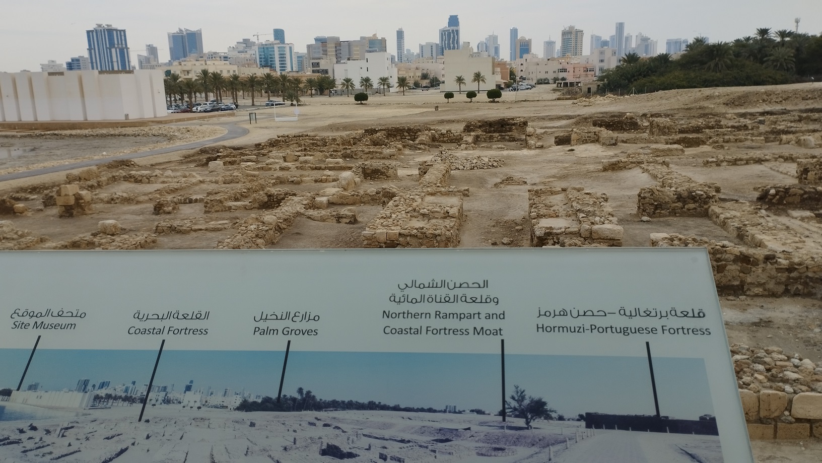
The Hormuzi – Portuguese Fortress – Qal’ at al-Bahrain – Kingdom of Bahrain
Qal’at al-Bahrain is a typical tell – an artificial mound created by many successive layers of human occupation. The strata of the 300 × 600 m tell testify to continuous human presence from about 2300 BC to the 16th century AD. About 25% of the site has been excavated, revealing structures of different types: residential, public, commercial, religious and military. They testify to the importance of the site, a trading port, over the centuries. On the top of the 12 m mound there is the impressive Portuguese fort, which gave the whole site its name, qal’a (fort). The site was the capital of the Dilmun, one of the most important ancient civilizations of the region. It contains the richest remains inventoried of this civilization, which was hitherto only known from written Sumerian references.
Bujairi Diriyah “The city of Hearth and the Jewel of the Saudi Arabia Kingdom
This property was the first capital of the Saudi Dynasty, in the heart of the Arabian Peninsula, north-west of Riyadh. Founded in the 15th century, it bears witness to the Najdi architectural style, which is specific to the centre of the Arabian peninsula. In the 18th and early 19th century, its political and religious role increased, and the citadel at at-Turaif became the centre of the temporal power of the House of Saud and the spread of the Salafiyya reform inside the Muslim religion. The property includes the remains of many palaces and an urban ensemble built on the edge of the ad-Dir’iyah oasis

Drakensberg South Africa UNESCO World Heritage Site
Douro Valley Portugal UNESCO World Heritage Site

Okavango Delta Maun UNESCO World Heritage Site

Elvas Aqueduct Portugal World Heritage by UNESCO

Ilha de Mocambique UNESCO World Heritage Site

Hercules Tower Coruna Spain UNESCO World Heritage Site
Ilha de Mozambique UNESCO World Heritage Site

Dubrovnik UNESCO World Heritage Site

Maloti Drakensberg Lesotho UNESCO World Heritage Site

Medina Fez Morocco UNESCO World Heritage Site

Moussem of Tan Tan – Morocco UNESCO World Heritage Site

Namib Sea Sand Desert UNESCO World Heritage Site

Stone Henge England UNESCO World Heritage Site

Old Town Edinburgh Scotland UNESCO World Heritage Site
Medina Marrakech UNESCO World Heritage Site

Okavango Delta UNESCO World Heritage Site

Sagrada Familia Barcelona UNESCO World Heritage Site

Su Nuraxi di Barumini Sardinia Italy UNESCO World Heritage Site

Victoria Falls Zambia UNESCO World Heritage Site

Heart of Neolithic – Standing Stones – Orkney, Scotland UNESCO World Heritage Site

Salamanca Royal Plaza Spain, UNESCO World Heritage Site
Hormuzi Portuguese Fortress Bahrain UNESCO World Heritage Site
Hercules Tower in Coruna UNESCO World Heritage Site
